Ridgeway Ward, ENG - Postcode - SN4 0AP
Postcode SN4 0AP serves Ridgeway Ward in the Wiltshire district of England. It is part of the SN4 outward code area. Use the map below for the exact location.
More postcodes in Wiltshire | Browse SN4 area | All postcodes in Ridgeway Ward
Location Information
| City/Location/Ward | Ridgeway Ward |
|---|---|
| County/District/Region | Wiltshire |
| States or Province or Territories | England |
| States or Province or Territories Abbrieviation | ENG |
| Postcode | SN4 0AP |
GPS Coordinate
| Item | Description |
|---|---|
| Latitude | 51.5525 |
| Longitude | -1.7046 |
Nearby Postcodes
| Location | Postcode |
|---|---|
| Ethandune ED | BA11 2PX |
| Ethandune ED | BA11 2QA |
| Ethandune ED | BA11 2RR |
| Southwick ED | BA11 6QL |
| Warminster | BA12 0AA |
| Warminster | BA12 0AB |
| Warminster Without ED | BA12 0AD |
| Upton Scudamore | BA12 0AE |
| Heytesbury | BA12 0AF |
| Upton Scudamore | BA12 0AG |
Browse All
Maps & Location
Ridgeway Ward is located in Wiltshire
About Ridgeway Ward
Introduction & Geography
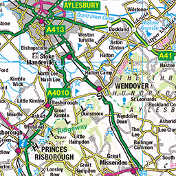
Ridgeway Ward is a two-member electoral ward within Buckinghamshire Council, located in the central part of Buckinghamshire. The current Buckinghamshire Council structure has 49 wards, and Ridgeway is divided into Ridgeway East and Ridgeway West rather than being a single ward officially named simply “Ridgeway.”
The two wards occupy a predominantly rural part of Buckinghamshire, within and around the Chiltern Hills. Their landscape is characterised by rolling chalk hills, agricultural fields, wooded slopes, villages, country lanes and extensive areas of open countryside. The setting is considerably more rural than the larger urban centres elsewhere in Buckinghamshire.
Ridgeway East includes the parishes of Great and Little Hampden, Hughenden, Ellesborough and Great and Little Kimble-cum-Marsh. Ridgeway West includes Bledlow-cum-Saunderton, Lacey Green, Bradenham, Radnage and Stokenchurch under the current arrangements.
The landscape is strongly influenced by the Chiltern escarpment and its associated valleys. The hills have historically affected settlement, agriculture and transportation, while the valleys provided more favourable locations for villages and farming. The area contains a mixture of high ground, wooded areas and valleys, producing some of the most attractive countryside scenery in Buckinghamshire.
Ridgeway East extends across countryside north and west of High Wycombe and towards the villages surrounding the Wendover and Princes Risborough areas. Ridgeway West stretches farther west and southwest towards Stokenchurch and the Buckinghamshire–Oxfordshire border.
The ward areas are connected by a network of rural roads and lanes, while larger roads provide access to nearby towns. The M40 motorway is particularly significant around Stokenchurch and provides a major connection towards London, Oxford and the wider motorway network.
The countryside is an important part of the local identity. Public footpaths and bridleways cross farmland and woodland, making the area popular with walkers, cyclists and people interested in outdoor recreation. The Chiltern landscape also provides habitats for numerous species of plants, birds and wildlife.
Although the area is rural, it is not isolated. High Wycombe, Princes Risborough, Aylesbury, Wendover, Marlow and other nearby centres provide employment, shopping, education, healthcare and leisure facilities.
The name Ridgeway is appropriate for an area whose landscape and history are closely connected with elevated routes across the Chilterns. Historic ridge routes provided important means of movement long before the modern road network developed.
History & Formation
The history of Ridgeway Ward extends far beyond its modern electoral boundaries. The villages and parishes within the ward have individual histories stretching back many centuries, while the wider Chiltern landscape has evidence of human activity dating to prehistoric periods.
The elevated Chiltern landscape was historically valuable for agriculture, woodland and movement. Ancient routes crossed the high ground, connecting settlements and trading communities. The Ridgeway name is particularly significant because the broader Ridgeway is one of Britain's best-known ancient routes, following high ground across southern England.
Over time, permanent settlements developed around farms, churches, springs, streams and crossroads. Many of the villages now associated with Ridgeway East and Ridgeway West retain historic layouts reflecting this earlier pattern of development.
Great Hampden and Little Hampden, for example, developed as rural communities surrounded by farmland and woodland. Ellesborough occupies an attractive position beneath the Chiltern escarpment, while Great Kimble and Little Kimble developed along the valley and routes through the Chilterns.
Hughenden has a particularly distinguished history. The village and surrounding estate became closely associated with Benjamin Disraeli, the nineteenth-century British prime minister, whose home at Hughenden Manor is now an important National Trust property.
On the western side, communities such as Bradenham, Lacey Green, Radnage and Stokenchurch developed from agricultural and woodland settlements into modern villages while retaining many historic features.
Agriculture remained the dominant economic activity for much of the area's history. Farms produced crops and livestock, while woodland supported timber production and traditional Chiltern industries. Small-scale crafts and rural trades supplemented farming.
The nineteenth century brought improved roads, industrialisation and railway development to surrounding parts of Buckinghamshire. Although many Ridgeway communities remained rural, their connections with nearby market towns became increasingly important.
The twentieth century produced further change. Improved road transport, rising car ownership and the growth of nearby towns allowed rural communities to become more closely connected with the wider regional economy.
Stokenchurch's location near the M40 later gave the western part of the area particularly strong road connections. Meanwhile, nearby High Wycombe became a major employment and commercial centre.
Modern electoral ward boundaries reflect this long development. Buckinghamshire's local government structure has changed over time, particularly following the creation of the unitary Buckinghamshire Council. Current ward arrangements divide the Ridgeway area into two two-member wards.
Buckinghamshire Council currently lists Ridgeway East and Ridgeway West as separate wards, each represented by two councillors.
The current Ridgeway East arrangement includes Great and Little Hampden, Hughenden, Ellesborough and Great and Little Kimble-cum-Marsh. Ridgeway West includes Bledlow-cum-Saunderton, Lacey Green, Bradenham, Radnage and Stokenchurch.
Thus, the modern wards are administrative areas, but their identity is built upon much older villages, parishes, estates and landscapes.
Popular & Notable Places
One of the most important attractions associated with Ridgeway East is Hughenden Manor, the former home of Benjamin Disraeli. The National Trust property combines an historic house, gardens, woodland and countryside, making it one of the area's major heritage destinations.
The wider Hughenden Valley is also notable for its scenery. The valley combines woodland, open fields and historic settlements and provides opportunities for walking and exploring the Chiltern landscape.
Ellesborough is another attractive village within Ridgeway East. It sits close to the Chiltern escarpment and is surrounded by countryside. Its position makes it particularly appealing to walkers and visitors interested in rural Buckinghamshire.
Great and Little Kimble are historically important villages with churches, traditional buildings and countryside surroundings. The villages form part of the wider landscape around the Misbourne and Upper Thame areas.
The Chiltern Hills are perhaps the defining attraction of both Ridgeway wards. Their combination of beech woodland, chalk grassland, valleys and farmland creates opportunities for walking, cycling and nature observation.
In Ridgeway West, Stokenchurch is one of the largest settlements. Its location close to the M40 gives it strong road connections, while the surrounding countryside retains a distinctly rural character.
Bradenham is particularly attractive for visitors interested in historic villages and Chiltern countryside. The village is associated with Bradenham Manor and the surrounding National Trust landscape.
Lacey Green is another notable village, known for its rural character and historic buildings. The village sits on high ground within the Chiltern landscape.
Radnage provides another example of a traditional Buckinghamshire village surrounded by farmland and woodland. Its setting illustrates the close relationship between settlement and countryside throughout the Ridgeway area.
The Ridgeway National Trail is also highly significant to the wider region. Although the exact trail alignment does not mean that every part of the electoral wards lies directly on the trail, the historic Ridgeway landscape is central to understanding the area's geography and heritage.
Nearby Princes Risborough provides a larger market-town centre with shops, restaurants, railway connections and community facilities. High Wycombe provides a substantially larger urban centre, with extensive shopping, employment, education and entertainment.
The area's attractions therefore extend beyond individual villages. Visitors can combine historic houses and churches with countryside walks, traditional villages and larger town-centre facilities.
Nearby Places & Postcodes
Ridgeway East and Ridgeway West are surrounded by numerous Buckinghamshire towns and villages. Because electoral boundaries and postcode boundaries are different systems, postcode districts should not be interpreted as exact ward boundaries.
Great Missenden is situated to the northeast and is associated mainly with the HP16 postcode district. It is a historic Chiltern village with attractive countryside and strong literary associations.
Princes Risborough lies close to the western and northern parts of the Ridgeway area and primarily uses the HP27 postcode district. It is an important local market town and transport centre.
High Wycombe is situated to the southeast and is one of Buckinghamshire's largest towns. It mainly uses the HP11, HP12, HP13, HP14 and HP15 postcode districts.
Marlow, located southeast of the Ridgeway area, is a well-known riverside town associated mainly with the SL7 postcode district.
Aylesbury, the county town of Buckinghamshire, lies to the northeast. It uses postcode districts including HP20, HP21 and HP22 and provides major administrative, commercial and cultural services.
Wendover lies near the northern side of the wider Ridgeway area and is primarily associated with the HP22 postcode district.
Chesham and Amersham lie farther east and northeast. Amersham is primarily associated with HP6, while Chesham is mainly HP5.
Stokenchurch is one of the most significant settlements within Ridgeway West and is primarily associated with the HP14 postcode district. It is particularly well connected to the M40.
Saunderton and Bledlow are smaller settlements associated with the western part of the area. Their countryside settings and proximity to Princes Risborough make them part of the wider rural community network.
The postcode districts found around Ridgeway East and West therefore include HP14, HP16, HP22 and HP27, together with neighbouring districts such as HP11–HP15, HP20–HP22 and SL7, depending on the specific settlement.
The current Buckinghamshire ward structure confirms that Ridgeway East and Ridgeway West are distinct two-member wards. Ridgeway East covers approximately the Great and Little Hampden, Hughenden, Ellesborough and Great and Little Kimble-cum-Marsh areas, while Ridgeway West covers Bledlow-cum-Saunderton, Lacey Green, Bradenham, Radnage and Stokenchurch.
Conclusion
Ridgeway Ward is best understood as part of the wider Ridgeway East and Ridgeway West area of Buckinghamshire rather than as a single current Buckinghamshire Council ward. The two wards encompass a collection of historic villages and parishes within an exceptionally attractive part of the Chiltern Hills.
The area's defining characteristics are its rolling countryside, historic settlements, woodland, farmland and strong connections to nearby market towns. Places such as Hughenden, Ellesborough, Great and Little Kimble, Bradenham, Lacey Green, Radnage and Stokenchurch each contribute their own history and character.
With access to High Wycombe, Princes Risborough, Aylesbury, Wendover and the wider London–Oxford corridor, the Ridgeway area combines rural living with good regional accessibility. Its historic landscapes and villages, together with attractions such as Hughenden Manor and the wider Chiltern countryside, make it an important and distinctive part of Buckinghamshire.