Finchampstead South Ward, ENG - Postcode - RG40 3RX
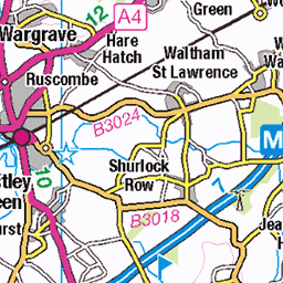
Postcode RG40 3RX serves Finchampstead South Ward in the Berkshire district of England. It is part of the RG40 outward code area. Use the map below for the exact location.
More postcodes in Berkshire | Browse RG40 area | All postcodes in Finchampstead South Ward
Location Information
| City/Location/Ward | Finchampstead South Ward |
|---|---|
| County/District/Region | Berkshire |
| States or Province or Territories | England |
| States or Province or Territories Abbrieviation | ENG |
| Postcode | RG40 3RX |
GPS Coordinate
| Item | Description |
|---|---|
| Latitude | 51.3703 |
| Longitude | -0.8564 |
Nearby Postcodes
| Location | Postcode |
|---|---|
| College Town Ward | GU15 4NR |
| College Town Ward | GU15 4NU |
| College Town Ward | GU15 4NX |
| College Town Ward | GU15 4NY |
| College Town Ward | GU15 4PA |
| College Town Ward | GU15 4PD |
| College Town Ward | GU15 4PE |
| College Town Ward | GU15 4PJ |
| College Town Ward | GU15 4PL |
| College Town Ward | GU15 4PQ |
Browse All
Maps & Location
Finchampstead South Ward is located in Berkshire
About Finchampstead South Ward
Introduction
Finchampstead South is a ward within the civil parish of Finchampstead in the Wokingham Borough area of Berkshire, England. It forms part of a parish whose landscape combines residential neighbourhoods, woodland, heathland, historic settlements and extensive countryside.
Finchampstead itself has a long history of settlement, with evidence connecting the area to the Iron Age, Roman occupation, Saxon and medieval periods and later developments. The old Roman road between London and Silchester, known locally as the Devil's Highway, passes through the parish and remains an important part of the area's historical landscape.
The modern ward is very different from the small rural community that existed centuries ago. Much of the present-day built environment developed during the twentieth century, particularly after the Second World War. Residential expansion, improved roads, commuting and changing employment patterns have transformed Finchampstead into a desirable part of the Wokingham area.
At the same time, Finchampstead South retains a strong rural identity. Woodland, commons, lakes, open spaces and countryside remain important elements of the landscape.
The ward therefore provides an interesting example of how a traditionally rural Berkshire parish has evolved into a modern residential community while retaining many of its historical and environmental characteristics.
Location
Finchampstead lies south and southwest of Wokingham, close to the borders with Hampshire and the neighbouring communities of Crowthorne and Arborfield.
The parish is situated between the M3 and M4 motorway corridors, giving it strong regional connections. The wider parish borders Wokingham to the north, Wokingham Without and Barkham to the east, Swallowfield to the west and Hampshire to the south.
This position gives Finchampstead South a useful combination of accessibility and relative separation from major urban centres.
Wokingham is close enough to provide employment, shopping, education and public services, while Reading, Bracknell and Basingstoke are also within the wider regional network.
London is further away but remains accessible to commuters through nearby road and rail connections.
The Modern Ward Structure
Finchampstead South is part of a relatively recent change in electoral geography.
Following the 2024 Local Government Boundary Commission for England review, Finchampstead was divided into four new borough wards: Finchampstead North, Finchampstead South, Finchampstead West and Lower Wokingham. These arrangements are due to take effect at the scheduled 2028 elections.
This distinction is important when discussing the name "Finchampstead South."
The wider Finchampstead parish has existed for much longer than the current electoral ward.
Historical descriptions, population statistics and community references may therefore use "Finchampstead" to describe the parish rather than the specific modern ward.
For anyone researching the area, it is useful to distinguish between parish geography and electoral geography.
Finchampstead Parish
Finchampstead is considerably larger than the impression given by its village centre.
The parish includes a mixture of residential communities, woodland, countryside and areas that have become suburbanised.
The neighbourhoods around California and the Finchampstead Ridges are particularly important to the modern identity of the parish.
The parish has also retained several historic features.
The local neighbourhood plan describes Finchampstead as having a history of continual settlement stretching from the Iron Age and Roman period through the Saxon and Norman eras, medieval England, the Tudor period, the Civil War and into modern times.
The Rural Origins of Finchampstead
Historically, Finchampstead was a rural community.
Agriculture, woodland and common land shaped the landscape.
Before modern roads and housing estates, much of the parish consisted of fields, heathland and woodland.
Historical records show that woodland represented a substantial part of the landscape.
An early nineteenth-century description recorded Finchampstead as lying within Windsor Forest, with woodland covering nearly half of its land.
This historical relationship with Windsor Forest helps explain why woodland remains such an important feature today.
Windsor Forest
The history of Finchampstead is closely connected with Windsor Forest.
During the medieval period, the area formed part of the royal forest associated with Windsor.
Forest law regulated land use and hunting, creating a distinctive relationship between local communities and woodland.
Over time, this system changed.
The forest landscape was gradually enclosed, particularly during the nineteenth century.
The enclosure of common and forest land transformed land ownership and agricultural practices.
It also contributed to the landscape that exists today.
Enclosure and Landscape Change
The enclosure process had major effects on Finchampstead.
Historical records identify an enclosure award for Finchampstead in 1817.
Enclosure reorganised land into more clearly defined holdings.
For landowners, this could improve agricultural management.
For people who had depended on traditional common rights, however, the consequences could be more complicated.
The landscape became increasingly organised into privately managed fields, plantations and estates.
Some of the straight roads and rides associated with the later landscape developed from this period of transformation.
The Woodland Landscape
Woodland is one of Finchampstead South's most defining characteristics.
Large areas of trees create a strong contrast with the more densely built parts of Wokingham.
Woodland also contributes to the area's identity as a semi-rural community.
The trees are not simply decorative.
They provide wildlife habitat, recreational opportunities, shade and carbon storage.
They also help create a sense of separation between neighbourhoods.
A journey through Finchampstead can therefore feel quite different from travelling through a conventional urban suburb.
Finchampstead Ridges
The Finchampstead Ridges are an especially distinctive landscape feature.
Finchampstead Ridges is an established open-space destination associated with the wooded and heathland landscape of the area.
The Ridges provide opportunities for walking, informal recreation and enjoying the countryside.
Their proximity to residential areas is particularly valuable.
Residents can experience a relatively natural landscape without having to travel far from home.
This is one of the factors contributing to the area's attractiveness.
California Country Park
Another major recreational resource is California Country Park.
The country park centres on Longmoor Lake and provides a mixture of woodland, water, open space and recreational facilities.
The local neighbourhood plan notes that the park was first developed in the early 1950s as a holiday camp and later became focused around the lake, camping and caravan facilities, visitor amenities and café.
Its history reflects the changing ways in which people have used the countryside for leisure.
What began partly as a holiday destination has become an important local recreational asset.
Longmoor Lake
Longmoor Lake gives California Country Park much of its character.
Water features are particularly valuable in suburban landscapes because they provide both visual interest and wildlife habitat.
Lakes can support water birds, insects, amphibians and aquatic vegetation.
They also provide opportunities for quiet recreation.
The lake demonstrates how a landscape originally shaped for leisure can develop additional environmental importance over time.
Rook's Nest Wood
Rook's Nest Wood Country Park is another green-space resource in the wider Finchampstead area.
Woodland country parks can provide accessible opportunities for walking and informal outdoor activity.
For residents, nearby woodland is particularly valuable because it offers a break from built-up surroundings.
For children, wooded landscapes can provide opportunities for exploration and environmental learning.
Simon's Wood
Simon’s Wood is another notable woodland area.
The significance of such woods goes beyond recreation.
Some parts of the wider woodland landscape preserve traces of historical routes and land use.
The Finchampstead neighbourhood plan specifically identifies the line of the old Roman road through Simon's Wood and other parts of the parish.
This means that walking through the woodland can also involve encountering traces of ancient history.
The Devil's Highway
One of Finchampstead's most fascinating historical features is the Roman road known locally as the Devil's Highway.
The route connected London with Calleva Atrebatum, the major Roman settlement near modern Silchester.
Its alignment runs east-west through the parish.
Although the original Roman road is not preserved everywhere as a modern visible road, sections of its earthwork, or agger, survive.
Its line is also reflected in modern roads and tracks.
The route forms part of the area's wider footpath and landscape network.
Roman Finchampstead
The Roman connection gives Finchampstead a history far deeper than its modern suburban appearance might suggest.
Roman roads were major pieces of infrastructure.
They allowed soldiers, officials, merchants and goods to move efficiently across Britain.
A route linking London with Silchester would have connected two important centres.
The continued visibility of parts of this route demonstrates how ancient infrastructure can influence modern landscapes.
Road alignments sometimes survive for centuries even after the original purpose of the route disappears.
Silchester
Silchester lies west of Finchampstead and is one of the most important archaeological sites in the surrounding region.
The Roman town of Calleva Atrebatum provides evidence of a substantial settlement with streets, buildings and defensive structures.
Its relationship with the Devil's Highway gives Finchampstead an important place in the wider Roman landscape of southern England.
Residents and visitors interested in history can therefore explore both the route and the archaeological destination to which it once led.
St James' Church
St James' Church is one of Finchampstead's most important historic landmarks.
The church dates back to the medieval period and marks the historic village centre.
The neighbourhood plan identifies the twelfth-century church as a significant element of the parish's heritage.
Its presence provides a visible connection with medieval Finchampstead.
Unlike many modern residential areas, the parish therefore retains a historic focal point that predates most of the surrounding development by centuries.
The Historic Village Centre
The old village centre around the church provides an important contrast with the later suburban areas.
The architecture and arrangement of buildings reflect a period when Finchampstead was a small rural settlement.
The absence of a large conventional town centre is itself notable.
Modern Finchampstead has developed as a dispersed collection of neighbourhoods rather than a single compact urban centre.
This has influenced local shopping, transport and community life.
The Queen's Oak
The Queen's Oak is a historic public house associated with Finchampstead.
The surrounding area has long been connected with traditional rural hospitality.
Public houses historically provided places for travellers, workers and local residents to meet.
They also served as informal community institutions.
Today, the surviving pub tradition provides an important connection with the social history of the parish.
Historic Buildings
Finchampstead contains a number of listed buildings.
The local neighbourhood plan identifies 28 listed buildings within the parish.
These buildings range from religious structures to historic houses and other properties.
Their survival is important because much of the surrounding residential landscape is comparatively modern.
Historic buildings therefore provide visual reminders of earlier periods.
The Elizabethan Cottage
An Elizabethan cottage in Dell Road is another heritage feature identified in local planning documents.
Buildings of this age are particularly valuable because relatively few survive in their original form after centuries of alteration and development.
Such structures help demonstrate the scale and character of the settlement before modern suburbanisation.
The Waterloo Connection
Finchampstead also has a connection with the Battle of Waterloo.
The area around Duke's Ride contains commemorative planting associated with the victory.
The avenue of Wellingtonia trees is a particularly striking landscape feature.
This demonstrates how historical events can become embedded in the physical landscape.
Trees can serve as living monuments.
They may survive long after the generation that planted them has disappeared.
Duke's Ride
Duke's Ride is one of the characteristic routes through the Finchampstead area.
Its landscape is associated with woodland, rhododendrons, gorse and heathland.
Some sections have become more suburban over time, with pavements, lighting, signs and roundabouts.
Nevertheless, the underlying woodland character remains visible.
The road illustrates the gradual transition from rural landscape to suburban settlement.
Post-War Development
Much of modern Finchampstead was built after the Second World War.
The local neighbourhood plan describes the settlement as largely post-Victorian, with a high proportion of post-war and modern estate housing.
This development changed the scale of the population.
New housing estates provided homes for families during a period of rapid national economic and demographic change.
The expansion also created demand for schools, roads, shops and recreation.
The California Area
California is one of the most recognisable modern communities within Finchampstead.
Its development is closely connected with the post-war expansion of the area.
The neighbourhood's name and landscape distinguish it from the older village centre.
Residential streets are interspersed with woodland and open areas.
The result is a suburban environment that retains strong connections with nature.
Why the Landscape Matters
The landscape is one of Finchampstead South's strongest assets.
In many parts of southern England, housing expansion has reduced the amount of countryside immediately accessible to residents.
Finchampstead retains a significant amount of woodland and open space.
This contributes to quality of life.
Residents can walk, exercise, observe wildlife and enjoy quieter surroundings.
The landscape also helps distinguish Finchampstead from more densely urbanised parts of the Wokingham Borough.
Biodiversity
Woodland, heathland, wetlands and grassland create a varied ecological environment.
Different habitats support different species.
Birds can use woodland and hedgerows for nesting.
Insects benefit from flowering plants and heathland.
Wetlands provide habitat for amphibians and aquatic species.
Maintaining ecological connections between these habitats is increasingly important.
Development that fragments habitats can reduce biodiversity even where individual green spaces remain.
Trees and Climate Resilience
Trees also have an important role in adapting communities to climate change.
They provide shade during hot weather.
Their roots can help stabilise soil.
Vegetation can absorb rainfall and reduce surface runoff.
Trees also improve the appearance of streets and public spaces.
For a community such as Finchampstead South, protecting mature woodland while incorporating new tree planting can contribute to long-term environmental resilience.
Walking and Footpaths
The footpath network is an important part of Finchampstead's character.
Historic routes, woodland paths and countryside tracks allow residents to explore the area without relying entirely on cars.
Some routes also follow or reflect historical infrastructure.
The connection between the Roman road and modern footpath network is particularly interesting.
Walking therefore provides both recreational and educational opportunities.
Cycling
Cycling can also be useful for local travel.
Finchampstead's relatively dispersed layout means that cycling can connect neighbourhoods with schools, shops and recreational areas.
However, safe cycling depends on infrastructure.
Busy roads and roundabouts can discourage inexperienced cyclists.
Better connections between residential areas and key destinations could encourage more people to use bicycles for everyday journeys.
Road Connections
Finchampstead benefits from its location between major motorway corridors.
The M3 lies to the south and the M4 to the north.
These routes provide access towards London, the Thames Valley, Hampshire and the wider South East.
Local roads connect Finchampstead with Wokingham, Crowthorne, Bracknell, Arborfield and surrounding villages.
The road network is therefore an important factor in the area's residential appeal.
Commuting
Commuting is a major part of life for many residents.
The proximity of Wokingham, Reading, Bracknell and Basingstoke provides access to a broad employment market.
Some residents also travel towards London.
The combination of attractive housing and regional employment opportunities has contributed to demand for homes in the area.
However, commuting can also increase traffic and place pressure on roads.
Public Transport
Public transport is important for residents who do not drive.
Bus services connect Finchampstead with Wokingham and other nearby communities.
Rail journeys generally involve travelling to nearby stations, particularly Wokingham, Crowthorne or other stations depending on the destination.
This makes local bus and road connections particularly important.
A reliable link to the railway network can significantly expand employment and education opportunities.
Schools
Education is an important component of community life.
Finchampstead has primary education facilities serving local families, including Finchampstead Church of England Primary School.
The school is situated near the historic village area and contributes to the continued importance of that part of the parish.
Secondary education is available through schools serving the wider Wokingham and surrounding area.
Family Life
Finchampstead South has many characteristics associated with family-oriented suburban living.
Housing estates provide family homes.
Schools are distributed through the wider parish.
Parks and woodland provide recreational opportunities.
The surrounding countryside offers additional space for outdoor activities.
These features help explain why Finchampstead has developed a reputation as an attractive residential location.
Community Facilities
Community facilities are essential in a geographically dispersed parish.
Because there is no single large traditional town centre, residents rely on a combination of local shops, schools, community buildings, churches, sports facilities and nearby larger centres.
This creates a different pattern of community life from that found in a compact market town.
People may identify strongly with their immediate neighbourhood while also seeing themselves as part of the wider Finchampstead community.
Local Shops and Services
Everyday shopping can be carried out through local facilities, while larger retail trips may take residents to Wokingham, Reading, Bracknell or Basingstoke.
The survival of local services is important because they provide convenience and reduce the need for every journey to involve a car.
Small businesses also contribute to community identity.
A local café, shop or service provider can become a familiar meeting point for residents.
Finchampstead's Character
The defining quality of Finchampstead South is the relationship between settlement and landscape.
Modern housing is present, but woodland remains close.
Roads carry substantial traffic, but footpaths lead into countryside.
Newer homes exist alongside medieval buildings.
The area has regional employment connections while retaining the atmosphere of a semi-rural community.
This mixture explains much of its appeal.
Looking Ahead
The future of Finchampstead South will involve managing continued demand for housing while protecting the environmental and historic features that distinguish the area.
The wider parish already faces development pressure.
Wokingham Borough Council's planning documents identify significant planned housing development in Finchampstead, with several sites expected to deliver hundreds of homes over the coming years.