Newtown Ward, ENG - Postcode - DA1 1TP
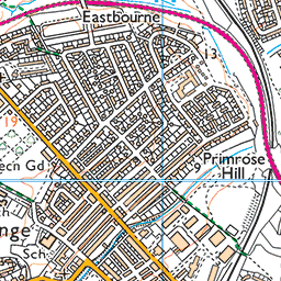
Postcode DA1 1TP serves Newtown Ward in the Kent district of England. It is part of the DA1 outward code area. Use the map below for the exact location.
More postcodes in Kent | Browse DA1 area | All postcodes in Newtown Ward
Location Information
| City/Location/Ward | Newtown Ward |
|---|---|
| County/District/Region | Kent |
| States or Province or Territories | England |
| States or Province or Territories Abbrieviation | ENG |
| Postcode | DA1 1TP |
GPS Coordinate
| Item | Description |
|---|---|
| Latitude | 51.445 |
| Longitude | 0.224 |
Nearby Postcodes
| Location | Postcode |
|---|---|
| Halstead, Knockholt and Badgers Mount Ward | BR6 7NZ |
| Well Hill | BR6 7PJ |
| Well Hill | BR6 7PL |
| Well Hill | BR6 7PN |
| Well Hill | BR6 7PP |
| Well Hill | BR6 7PR |
| Well Hill | BR6 7PS |
| Well Hill | BR6 7PT |
| Well Hill | BR6 7PU |
| Well Hill | BR6 7PW |
Browse All
Maps & Location
Newtown Ward is located in Kent
About Newtown Ward
Introduction & Geography
Newtown Ward is a local electoral area associated with the town of Newtown in Buckinghamshire, England. The name Newtown is used for several places across the United Kingdom, so the Buckinghamshire context is important when discussing the ward. Within Buckinghamshire, Newtown is associated with the wider Chiltern and Wycombe area, where historic settlements, residential neighbourhoods and rolling countryside form the dominant landscape.
The ward's environment reflects the broader character of Buckinghamshire. Residential streets are interspersed with established green spaces, roads, community facilities and areas of open land. The surrounding countryside is characterised by fields, hedgerows and woodland, while nearby larger settlements provide employment, shopping and public services.
Newtown's position within the Buckinghamshire settlement network means that it is connected to several important towns. High Wycombe is one of the principal nearby urban centres and provides extensive commercial, educational, healthcare and leisure facilities. Other nearby settlements include Marlow, Beaconsfield, Amersham, Princes Risborough and villages throughout the Chilterns.
The geography of the area is influenced by the Chiltern Hills, which provide gently undulating terrain and extensive countryside. The hills are particularly well known for beech woodland, chalk grassland and scenic walking routes. This rural landscape has historically influenced where communities developed and how they were connected.
Transport is an important feature of the wider area. Roads connect local neighbourhoods with High Wycombe and surrounding villages, while railway services in nearby towns provide connections towards London and other parts of southern England. The M40 motorway is particularly significant for regional travel, linking Buckinghamshire with London, Oxford and the wider motorway network.
Newtown Ward's character is therefore influenced by its combination of residential development, local community facilities and access to surrounding countryside. The area benefits from being close to larger commercial centres without losing its connection to the quieter communities and landscapes of Buckinghamshire.
As with all electoral wards, the precise boundaries of Newtown Ward depend on the local-government arrangements in force. Electoral boundaries can be reviewed and altered, so the geographical area covered by a ward should be distinguished from the broader place-name “Newtown.”
History & Formation
The history of Newtown Ward is connected to the wider development of settlement and local government in Buckinghamshire. The name “Newtown” generally reflects the development of a settlement or neighbourhood that grew beyond an older established centre.
Buckinghamshire has a long history of settlement. Archaeological evidence across the county indicates human activity stretching back to prehistoric periods. The Chiltern landscape provided resources including woodland, agricultural land and water, while ancient routes connected communities across the region.
During the medieval period, many Buckinghamshire settlements developed around manors, churches, farms, markets and crossroads. Agriculture was the principal economic activity, with surrounding farmland supporting local populations.
The growth of market towns such as High Wycombe and nearby communities encouraged the development of roads and trading connections. Villages and smaller neighbourhoods increasingly became connected to these centres.
The Industrial Revolution brought substantial changes to southern Buckinghamshire. High Wycombe became particularly well known for furniture and chair manufacturing, creating employment and encouraging population growth. This expansion had a wider influence on surrounding settlements and contributed to the development of new residential areas.
During the nineteenth century, railway construction transformed Buckinghamshire. Railways made travel to London and other towns considerably easier and encouraged further economic and residential development.
The twentieth century saw much more extensive suburban growth. New housing was constructed to accommodate increasing populations, particularly after the Second World War. Roads, schools, shops and community facilities expanded alongside residential neighbourhoods.
The growth of the London commuter belt further increased demand for homes in Buckinghamshire. Communities that had previously been predominantly rural or semi-rural increasingly became residential areas for people working in High Wycombe, London and other parts of the South East.
Modern electoral wards were created and subsequently revised to provide effective local democratic representation. Newtown Ward therefore represents a contemporary administrative arrangement within a landscape shaped by centuries of settlement.
The area's development reflects a common Buckinghamshire pattern: historic rural communities gradually became incorporated into expanding urban and suburban networks while retaining elements of their earlier identity.
Today, the legacy of this development can be seen in the mixture of older buildings, established residential streets, modern housing, local facilities and surrounding green spaces.
Popular & Notable Places
The attractions associated with Newtown Ward depend on its precise boundary, but the surrounding Buckinghamshire area contains numerous places of historical, cultural and recreational interest.
High Wycombe is one of the most important nearby destinations. The town has a long industrial heritage, particularly its association with furniture manufacturing. Today it provides extensive shopping, restaurants, entertainment, education, employment and transport facilities.
The Wycombe Museum is particularly useful for understanding the history of High Wycombe and the surrounding area. Its collections include material relating to local industries, furniture production and everyday life.
The Chiltern Hills are another major attraction. The countryside around Newtown and the wider Wycombe area offers walking routes through woodland, farmland and open landscapes. The area is particularly attractive to people interested in hiking, cycling and nature.
Hughenden Manor, near High Wycombe, is an important historical attraction. The National Trust property was the home of Benjamin Disraeli and contains an historic house, gardens and extensive surrounding countryside.
West Wycombe is another notable nearby destination. Its historic village, estate, church and hill landscape provide an important combination of architectural and natural heritage.
West Wycombe Park is known for its landscaped grounds and historic architecture, while the village itself contains traditional buildings and historic features.
Marlow, situated on the River Thames, is another popular nearby town. It is known for its riverside setting, historic streets, shops, restaurants and walking opportunities.
Beaconsfield provides another historic market-town destination. Its Old Town contains traditional buildings, independent businesses and historic streets, while the newer part of the town offers modern services.
Amersham and Chesham are also within the wider Chiltern network. Amersham is known for its historic Old Town and strong London transport connections, while Chesham has a distinctive market-town and industrial heritage.
For recreation, the surrounding countryside provides numerous public footpaths and green spaces. These routes allow residents to travel through rural landscapes and connect with neighbouring villages without relying entirely on major roads.
Local churches, village halls, sports facilities and community centres also contribute to the area's identity. Although these locations may not attract large numbers of tourists, they are important gathering places for residents.
The area's notable places therefore reflect several aspects of Buckinghamshire's character: industrial heritage, historic architecture, countryside, transport connections and community life.
Nearby Places & Postcodes
The exact postcode coverage of Newtown Ward depends on the specific Buckinghamshire locality to which the ward refers. Postcode boundaries do not correspond directly with electoral ward boundaries, so the complete postcode of an individual address should be used when precise identification is required.
High Wycombe is the principal nearby town and is primarily associated with postcode districts HP11, HP12, HP13, HP14 and HP15. It provides major shopping, employment, education and transport facilities.
Marlow lies southeast of High Wycombe and is primarily associated with the SL7 postcode district. The town is known for its position on the River Thames and attractive historic centre.
Beaconsfield lies southeast of the wider area and is mainly associated with HP9 and HP10. It has both a historic Old Town and modern commercial areas.
Amersham lies farther east and primarily uses the HP6 postcode district. It is an important Chiltern market town with Underground and National Rail connections.
Chesham lies northeast of Amersham and mainly uses HP5.
Princes Risborough lies northwest of High Wycombe and is primarily associated with HP27. It is a historic market town surrounded by Chiltern countryside.
Great Missenden is another nearby Chiltern settlement, mainly using HP16. It is known for its attractive valley setting and historic village environment.
Aylesbury, the county town of Buckinghamshire, lies farther north. Its principal postcode districts include HP20, HP21 and HP22. It provides major administrative, commercial, educational and cultural services.
The wider area also contains villages such as Hazlemere, Hughenden, Naphill, Downley, Lane End, Penn and Wooburn Green, depending on the exact locality being considered.
The HP postcode area is dominant across much of Buckinghamshire's Chiltern region. However, the presence of an HP postcode does not itself establish that an address belongs to Newtown Ward. Postcode districts cover relatively broad areas and may cross parish, town and electoral boundaries.
Transport connections are another important consideration when examining nearby places. High Wycombe railway station provides services towards London and Birmingham, while stations at Amersham, Beaconsfield, Marlow and Princes Risborough offer additional regional connections.
The M40 provides an important road connection through the wider region, while local roads link smaller communities with High Wycombe and surrounding towns.
Conclusion
Newtown Ward forms part of the wider Buckinghamshire community network, combining residential development with convenient access to the Chiltern countryside and nearby urban centres. Its character has been influenced by the long history of settlement in the county, the industrial development of High Wycombe, railway expansion and the growth of the South East commuter belt.
The surrounding area offers a wide variety of attractions, from historic villages and country estates to museums, riverside towns and extensive walking routes. High Wycombe provides the principal urban centre, while Marlow, Beaconsfield, Amersham, Chesham, Princes Risborough and Great Missenden provide additional destinations.
The combination of residential communities, green spaces, transport links and proximity to the Chiltern landscape makes the Newtown area an interesting part of Buckinghamshire. Because ward boundaries can change and the name “Newtown” is used in several locations, the exact current ward boundary and postcode should always be verified when information is required for a particular address or electoral purpose.